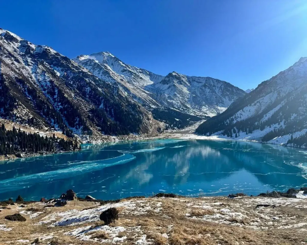
Big Almaty Lake shows up on almost every “best of Kazakhstan” list, and for good reason. It’s a turquoise alpine reservoir tucked into the Trans-Ili Alatau, close enough to the city that you can be standing on the shore before lunch. But here’s the thing: half of what gets written about it online is already out of date.
I grew up in Almaty before my family moved away in the 1990s, and I still go back most years to visit relatives. Every trip, something about this lake has changed: a new gate, a new fee, a new rumor about the road reopening. This guide covers what the lake actually is, why the water changes color, and what getting there really looks like right now, not what a tour brochure from three years ago says.
In This Article
- What Is Big Almaty Lake, and Why Is It So Famous?
- Why Does the Water Change Color Through the Year?
- How Do You Actually Get to Big Almaty Lake in 2026?
- What Does It Cost to Visit, and What Are the Rules?
- What’s Powering Almaty Behind the Scenes at This Lake?
- Is Big Almaty Lake Worth Combining With Other Stops?
- When Is the Best Time to Visit Big Almaty Lake?
- Frequently Asked Questions About Big Almaty Lake
- Where This Leaves You

Alma Zharkyn left Almaty as a child in the 1990s and has been returning almost every year since. She writes Almaty Guide for American travelers who want practical, current information from someone who still has family in the city.
What Is Big Almaty Lake, and Why Is It So Famous?
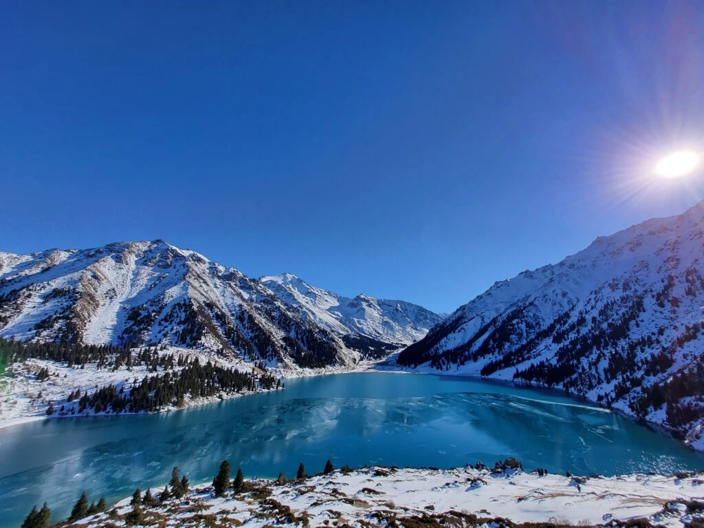
Big Almaty Lake, often searched as big almaty lake kazakhstan, is a natural alpine reservoir sitting at 2,511 meters above sea level in the Trans-Ili Alatau range, about 15 kilometers south of central Almaty. It formed thousands of years ago when a powerful earthquake triggered a landslide that dammed the upper Bolshaya Almatinka River, and that debris later fused with an old glacial moraine into a natural dam of solid porphyry rock.
The lake stretches about 1.6 kilometers long and up to a kilometer wide, with a coastline just under 3 kilometers. Depth varies by season, but it typically runs between 30 and 45 meters, holding somewhere around 13 to 14 million cubic meters of water.
Three peaks ring the basin: Sovetov at 4,317 meters, Ozernaya just over 4,100 meters, and Turist at nearly 3,954 meters. On a clear day you can see all three from the dam at the lake’s northern edge, which is also where most visitors get their first look at the water.
Why Does the Water Change Color Through the Year?
The short answer? Glacial melt. Big Almaty Lake is fed by meltwater from the glaciers ringing it, and how much sediment that water carries changes with the season, which changes the color you actually see.
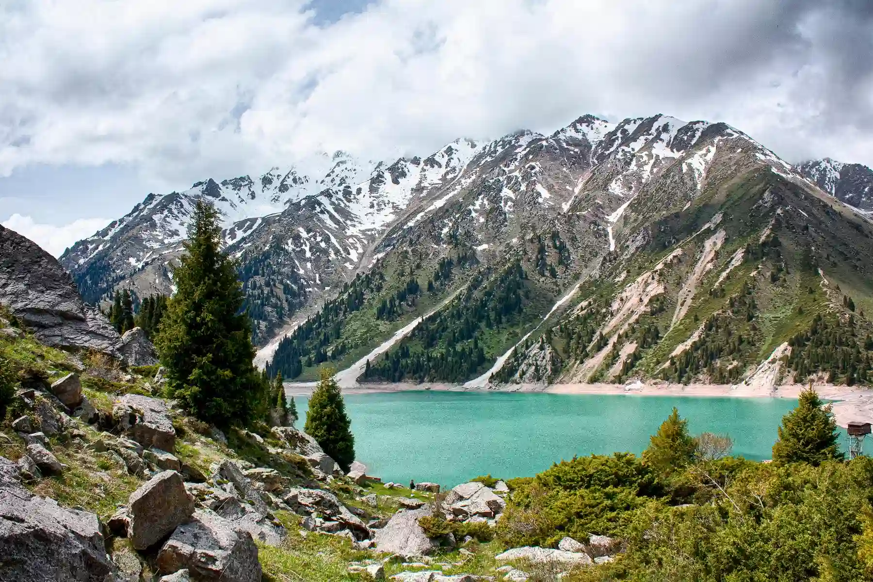
In spring, as the ice sheet breaks up, the water runs pale and almost milky blue. Sediment loads are low, so there’s not much yet to cloud the color.
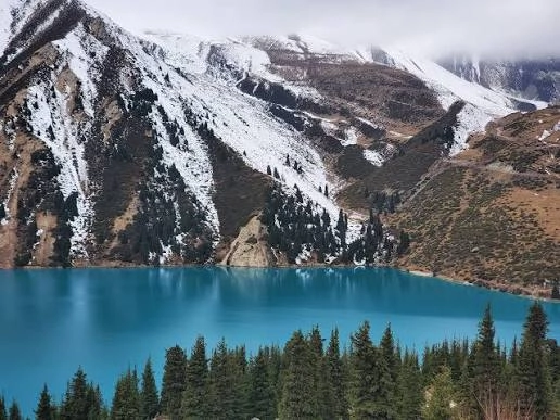
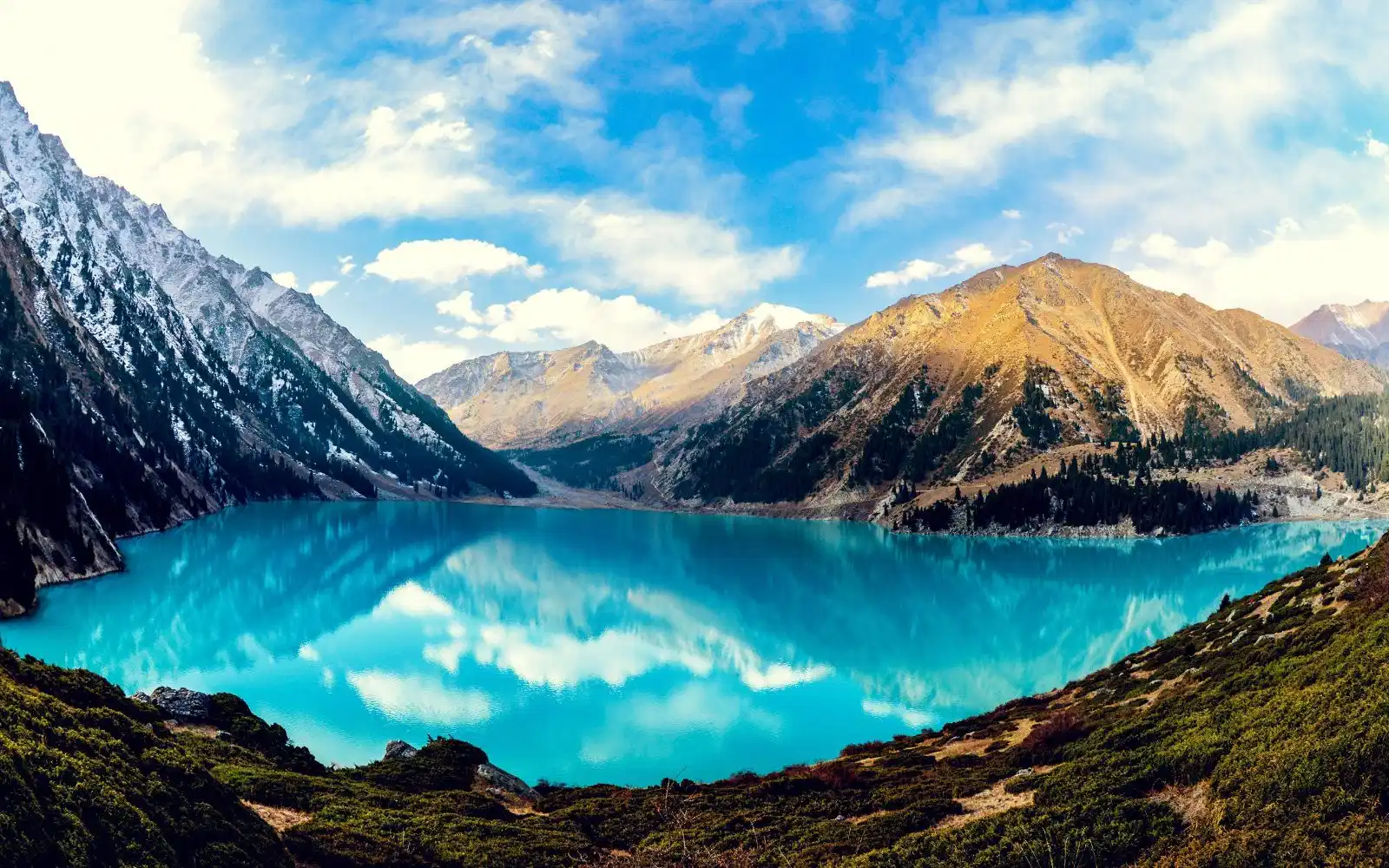
By midsummer, intense glacial melting pushes fine rock flour, crushed granite and porphyry ground down by the glaciers above, into the lake. That gives it a turbid, slightly cloudy turquoise. Come September and October, the melt slows, the particles settle out, and the water turns into the deep jewel turquoise blue that shows up in every postcard.
Winter is the quiet season. Water levels drop as the city draws down the reservoir for drinking water and power, and the surface often freezes over into a pale icy blue. If you’ve seen photos where the lake looks almost gray, that’s probably a winter shot, not a bad camera.
How Do You Actually Get to Big Almaty Lake in 2026?
You can’t drive all the way to almaty lake anymore, at least not officially. Since 2019, private cars, taxis, and e-bikes have been stopped at a barrier roughly 10 kilometers before the lake, and that rule has been enforced on and off ever since.
The road briefly reopened to private vehicles in 2023, and the surge in visitors that followed created traffic jams and litter problems serious enough that authorities removed thousands of kilograms of waste from the area in a matter of weeks. And it gets more complicated: by late September 2023, the barrier went back up, and it’s stayed there since.
In my experience, the altitude makes the climb feel longer than the map suggests, even for people who hike regularly at lower elevations. Give yourself more time than a fitness app would estimate.
Here’s what your options actually look like right now:
- Hike from the barrier: 6 to 8 kilometers, about 800 meters of elevation gain, roughly 2 to 3 hours going up.
- Rent a bicycle or moped at the barrier for a faster climb, cash only.
- Book a guided tour. Some still drive guests up unofficially, and enforcement varies week to week.
“Officially the lake is off limits to private vehicles. Unofficially, plenty of tours still find a way around it.”
Alma Zharkyn, Almaty Guide, based on 2026 traveler reports
A new hiking trail is reportedly under construction, with an expected finish date of late 2026, meant to give visitors a proper, sanctioned route instead of the current barrier-and-climb setup. Until it’s actually done, treat any promise of driving straight to the shore with some skepticism.
What Does It Cost to Visit, and What Are the Rules?
Expect to pay a small entrance fee at the eco-post checkpoint, roughly 200 Kazakhstani tenge per person as of late 2025, though prices at Kazakhstan’s national parks tend to shift from year to year. Bring cash in small bills, since card readers are unreliable this far up the mountain.
Ile-Alatau National Park also publishes a broader fee schedule covering guided services and trail use, which runs from a few hundred tenge for basic access up to several thousand for services bundled into an organized tour.
The rules themselves are simple and non-negotiable. Swimming, boating, and wading into the water are all banned, because this is Almaty’s drinking water supply, not a swimming hole. Camping, bonfires, and picking plants inside the national park boundary are off-limits too.
What’s Powering Almaty Behind the Scenes at This Lake?
Big Almaty Lake isn’t just scenery, it’s infrastructure. The lake supplies drinking water to the city and feeds the Cascade of Almaty Hydroelectric Power Stations, which is exactly why access to it has always been so tightly controlled.
So why does this matter for you as a visitor? Back in the early 1950s, Soviet engineers built an intake system at the northern dam, feeding a large steel pipeline locals still call “the tube” down the gorge to the turbines below. That same pipeline is why the steep shortcut trail up from the barrier runs right alongside it.
In the 1970s and 80s, the state agency Kazglavselezaschita reinforced the natural dam with concrete to guard against mudflow damage and glacial lake outburst floods, a real risk in a range where glaciers are retreating fast. The reservoir is generally filled to capacity by around November 1 each year to build up a reserve for winter power generation, then drawn down through the coldest months.
Above the lake, the mountain road keeps climbing toward the Tien Shan Astronomical Observatory and, higher still, a cosmic ray research station that’s been recording data since the late 1940s. Neither is set up for casual visitors, but it’s a good reminder that this gorge has been doing serious scientific work for over seven decades.
Is Big Almaty Lake Worth Combining With Other Stops?
Yes, and most visitors already do. Big Almaty Lake sits inside Ile-Alatau National Park alongside several other stops that pair well with a single day trip, so you’re not just visiting one kazakhstan lake and heading straight back to the city.
- Alma-Arasan hot springs gorge, a short drive from the eco-post, popular for its natural mineral springs.
- Shymbulak ski resort, reachable by cable car and a common add-on for travelers with an extra half day.
- Ayusai Visitor Centre, useful less for the scenery and more as a reliable source on current road status.
But there’s a catch. Don’t try to cram everything into one trip if you’re already committing to a 2 to 3 hour hike each way. Pick one add-on, not three, or you’ll spend more time in transit than at any of the actual sights.
When Is the Best Time to Visit Big Almaty Lake?
Late summer through early autumn, roughly August through October, gives you the best shot at that deep turquoise color and stable weather for the hike. Spring is beautiful too, just be ready for pale blue water instead of the postcard turquoise.
Temperatures swing hard by month, and that matters more than people expect when they’re climbing 800 vertical meters at altitude. Worth pausing on that for a second, since the same trail that’s a pleasant walk in September can be genuinely cold and icy by November. Here’s what the official 1991 to 2020 climate averages look like:
| Month | Daily Mean Temperature | What to Expect |
|---|---|---|
| January | -8.3°C (17°F) | Frozen surface, lake near winter drawdown |
| April | 2.1°C (36°F) | Thaw begins, water turns pale milky blue |
| July | 12.0°C (54°F) | Warmest month, peak glacial melt and turbidity |
| September | 7.5°C (45°F) | Turquoise season begins, sediment settling |
| October | 2.4°C (36°F) | Clearest, deepest color, cooling fast |
Whatever month you go, pack layers. Even in July the wind off the peaks can cut through a t-shirt fast, and afternoon weather at this elevation turns without much warning.
Frequently Asked Questions About Big Almaty Lake
Is Lake Almaty the Same Place as Big Almaty Lake?
Yes, mostly. “Lake Almaty” and “Almaty Lake” are just informal ways people search for Big Almaty Lake, the alpine reservoir south of the city. There isn’t a separate lake going by that exact name in the area. If you see a listing calling itself simply “Almaty Lake,” it’s almost certainly referring to this same reservoir at 2,511 meters, not a different body of water.
Can You Swim in Big Almaty Lake?
No. Swimming, wading, and boating are all banned because the lake supplies Almaty’s drinking water. Park rangers do enforce this, and the water is glacier-fed anyway, so it sits around 8 to 13°C even in summer. Stick to photos from the shore or the dam viewpoint instead.
How Long Does the Hike to Big Almaty Lake Take?
Budget 2 to 3 hours going up from the vehicle barrier, and somewhat less coming back down. Think about it this way: the distance runs 6 to 8 kilometers depending on route, with about 800 meters of elevation gain along a paved but steadily uphill road. Fitness level and altitude acclimation matter more here than raw distance, so build in extra time if you’re arriving straight from sea level.
Do You Need a Guide or Tour to Visit?
Not strictly, no. You can hike or cycle up independently once you’ve paid the eco-post entrance fee. That said, a guided tour simplifies transport logistics, especially since the vehicle restrictions mean getting from central Almaty to the barrier and back can eat up a chunk of your day without a car of your own.
Where This Leaves You
Big Almaty Lake is worth the trip, the color alone makes that case. But treat anything you read about driving straight to the shore with a healthy dose of doubt, because the access situation has flipped at least three times in the past six years.
The way I look at it, the smartest move is checking status right before you go, either through the Ayusai Visitor Centre or a local tour operator, rather than trusting whatever a blog post said a year ago. Plan for a hike, and treat the drive as a bonus if it happens to be open.
Pack for altitude, respect the no-swimming rule, and give yourself the full half day. This is one of the rare spots near Almaty where the reservoir, the mountains, and a little Soviet-era engineering history all show up in the same afternoon.
Sources
- Wikipedia. “Ile-Alatau National Park.” Wikipedia, 2026.
- World Heritage Journeys of Europe. “Ile-Alatau National Park.” visitworldheritage.com, 2026.
- Eternal Arrival. “Big Almaty Lake: The Reality of Visiting in 2026.” eternalarrival.com, 2026.
- Kazakh Tourism. “Big Almaty Lake New Hiking Trail in 2026.” kazakh.travel, 2026.
- Trip.com. “How to Get to Big Almaty Lake.” trip.com, 2026.
- Kaganat. “Big Almaty Lake Guide: How to Visit & Current Status.” kaganat.kz, 2025.