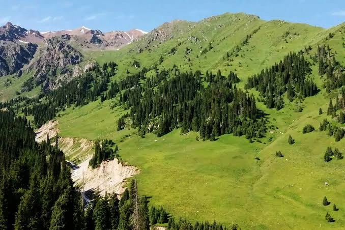
If you want real mountains right at Almaty’s doorstep, Ile-Alatau National Park is where you go. Covering 200,160 hectares of the Trans-Ili Alatau range, it is the city’s mountain backyard—close enough for a half-day trip yet expansive enough for multi-day alpine trekking.
Here’s the full picture: the landscape, 46 tourist routes, Big Almaty Lake, wildlife, and how to plan an independent or guided mountain visit.
Established
1996
Total Area
200,160 Hectares
Official Routes
46 Marked Trails
Quick Facts
| Detail | Info |
|---|---|
| Established | 1996 |
| Total Protected Area | 200,160 hectares |
| Location | Trans-Ili Alatau range (Northern Tien Shan), south of Almaty |
| Official Tourist Routes | 46 marked mountain trails |
| Primary Landmark | Big Almaty Lake (BAO, 2,511m elevation) |
| Notable Peaks | Sovetov Peak (4,317m), Ozerny Peak (4,110m), Tourist Peak (3,954m) |
| Entrance Fee | ~1,000 KZT (about $2 USD) per adult |
| Operating Hours | Daily 09:00 a.m.–06:00 p.m. at main checkpoints |
Park Overview & Geography
Ile-Alatau National Park stretches for over 120 kilometers along the northern slope of the Trans-Ili Alatau mountains, from Turgen Gorge in the east to the Chemolgan River in the west.
- Mountain Ecosystems: Spans glaciated peaks, alpine tundra, subalpine meadows, and dense Tian Shan spruce forests.
- Borders State Reserve: Adjoins the strictly protected Almaty State Nature Reserve along higher mountain ridges.
- Accessibility: Offers well-maintained roads, visitor centers, and 46 official marked routes suitable for day hikers and trekkers.
High-Altitude Mountain Peaks
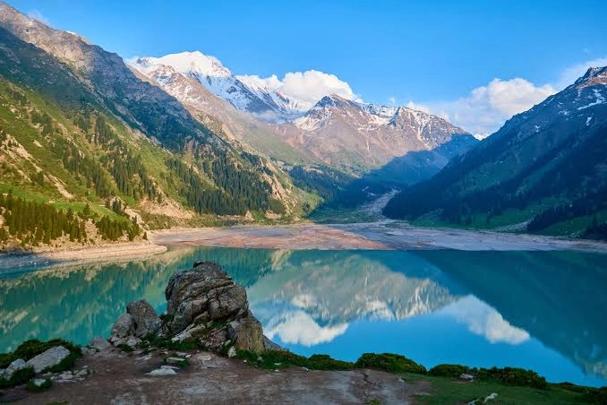
Peaks exceeding 4,000 meters ring the park’s central valleys. Sovetov Peak (4,317m), Ozerny Peak (4,110m), and Tourist Peak (3,954m) form the iconic alpine skyline visible behind Big Almaty Lake.
Mountain weather shifts rapidly; clear sunny mornings can bring afternoon rain or mountain fog. Packing thermal layers and rain protection is essential even on warm summer days.
Big Almaty Lake (BAO)
Big Almaty Lake is the single most famous natural site in the park:
- Elevation & Size: Sits at 2,511 meters altitude, measuring 1.6 km long and up to 40 meters deep.
- Glacial Water: Formed roughly 2,000 years ago when a landslide dammed the river basin.
- Reservoir Rules: Supplies drinking water to Almaty; swimming and walking near the immediate shoreline are strictly prohibited.
- Best Photo Timing: Morning light (08:00 to 11:00 a.m.) brings out the lake’s most brilliant turquoise color.
Hiking Routes & Valleys
- Big Almaty Lake Trail: A popular 6–8 km walk gaining 300 meters elevation to the lake overlook.
- Big Almaty Gorge: A scenic forested river valley with trails leading toward alpine passes.
- Alma-Arasan Thermal Springs: A detour trail leading to natural warm mineral springs.
- Multi-Day Alpine Treks: High-altitude trails crossing mountain passes, suitable for experienced hikers with camping gear.
Tours vs Independent Travel
- Public Bus: Bus 28 travels from central Almaty to the entrance of Big Almaty Gorge (drops near the lower trail).
- Taxi / Yandex Go: A 30-minute ride from the city center directly to main valley trailheads.
- Guided Tours: Ideal for visitors wanting organized transport, guides, and pre-arranged park fees.
Wildlife & Ecosystems
The park preserves diverse wildlife including Siberian ibex on rocky crags, marmots and pikas on subalpine meadows, and golden eagles in higher thermals. The remote high-altitude zones support protected snow leopard populations.
Nearby Mountain Attractions
- Medeu High-Altitude Rink: World-famous ice rink located at the park border.
- Shymbulak Mountain Resort: Premier Central Asian ski resort connected to Medeu by cable car.
- Almaty State Nature Reserve: Strictly protected wilderness bordering the park to the south.
Best Time to Visit
- Spring (Apr–Jun): Blooming alpine flora in lower valleys; high passes remain snow-covered.
- Summer (Jul–Aug): Prime window for reaching Big Almaty Lake and high alpine trekking.
- Autumn (Sep–Oct): Crisp clear days, golden spruce foliage, and excellent visibility.
Tips for Visiting
Route-First Planning: Ile-Alatau spans 200,160 hectares across multiple valleys. Pick one specific named entry checkpoint (such as Big Almaty Gorge or Medeu) and an achievable route before leaving Almaty. Pack extra warm clothing layers and carry out all waste.
Official Information
Primary source
Forestry & Wildlife Committee — Ile-Alatau National Park official report
Facts reviewed 17 July 2026. Recheck time-sensitive details before travel.
Frequently Asked Questions
How far is Ile-Alatau National Park from Almaty?
Big Almaty Lake, the park’s primary landmark, sits about 15 km south of central Almaty, roughly a 30-minute drive.
Do I need a tour to visit Ile-Alatau National Park?
No. Independent travel by public bus 28, taxi, or rideshare app is very easy for main trailheads.
What is there to see at Ile-Alatau National Park?
Big Almaty Lake, 4,000m peaks, 46 marked hiking routes, alpine meadows, spruce forests, and wildlife.
What is the entrance fee for Ile-Alatau National Park?
The standard park entrance fee is roughly ~1,000 KZT (~$2 USD) per adult at main entry checkpoints.
When is the best time to visit?
Summer and early autumn (July to October) offer the most comfortable hiking weather and open mountain passes.
Wrapping Up
Ile-Alatau National Park is one of the easiest ways to experience genuine mountain wilderness right beside a major city. Whether visiting Big Almaty Lake for a half-day or hiking deeper into the range, it is an essential part of any Almaty itinerary.
A specific modest route is safer and more rewarding than a vague ambitious day in the mountains.